blah blah blah
Kilburn Crags
Length: 1.7 miles out-and-backDifficulty (click for info): Beginner
Elevation Gain: 400 feet (+40 feet on return)
Rating (click for info): 6/10
Elevation: 1455'
Prominence: 39'
Driving Directions:
Travel on I-93 to exit 43. At the end of the off-ramp (either direction), turn right (south) and proceed a short distance to the intersection of Rts. 18 and 135. Take a right and drive half a mile west on Rt. 18. At the near end of the second large field on your left, look for the kiosk and small pull-in parking. There is room for two cars to park straight in and space for more on the road shoulder. Click here for a Google map.
About the Hike:
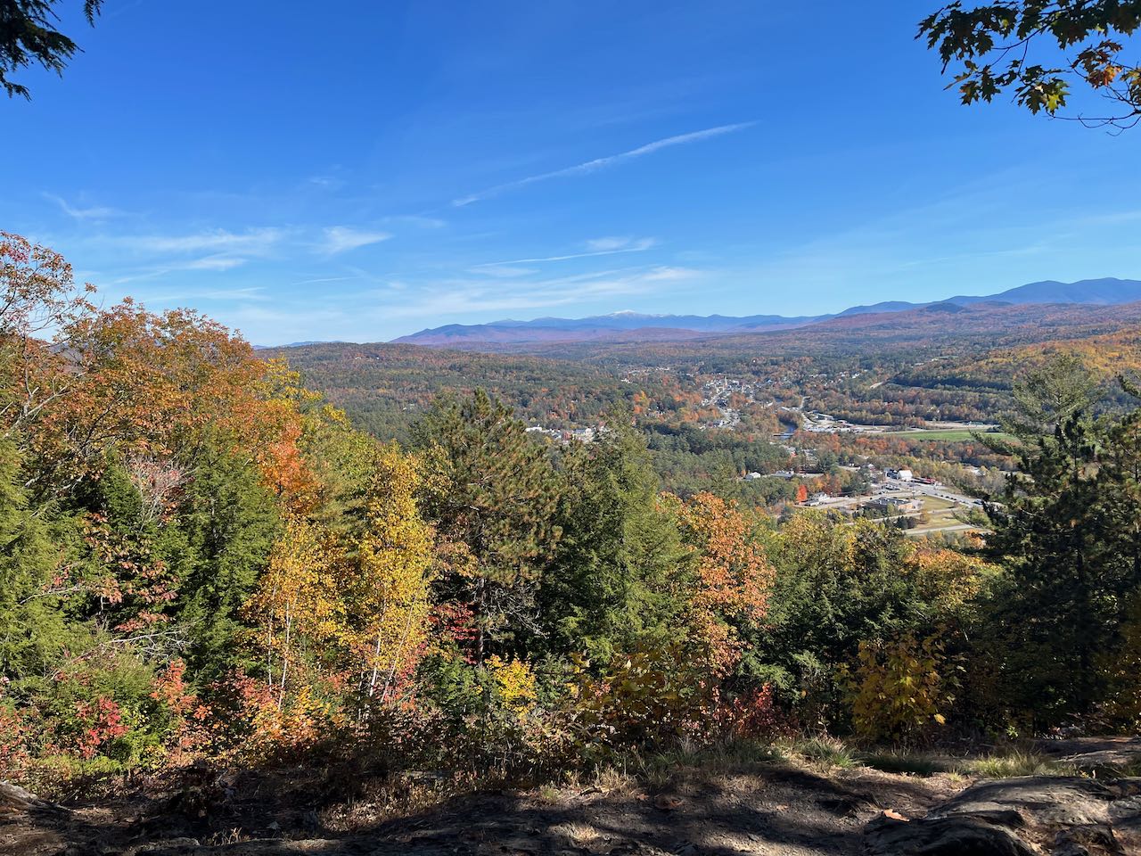
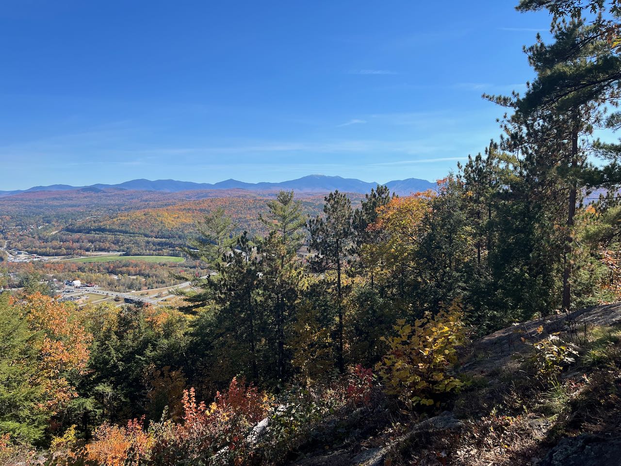
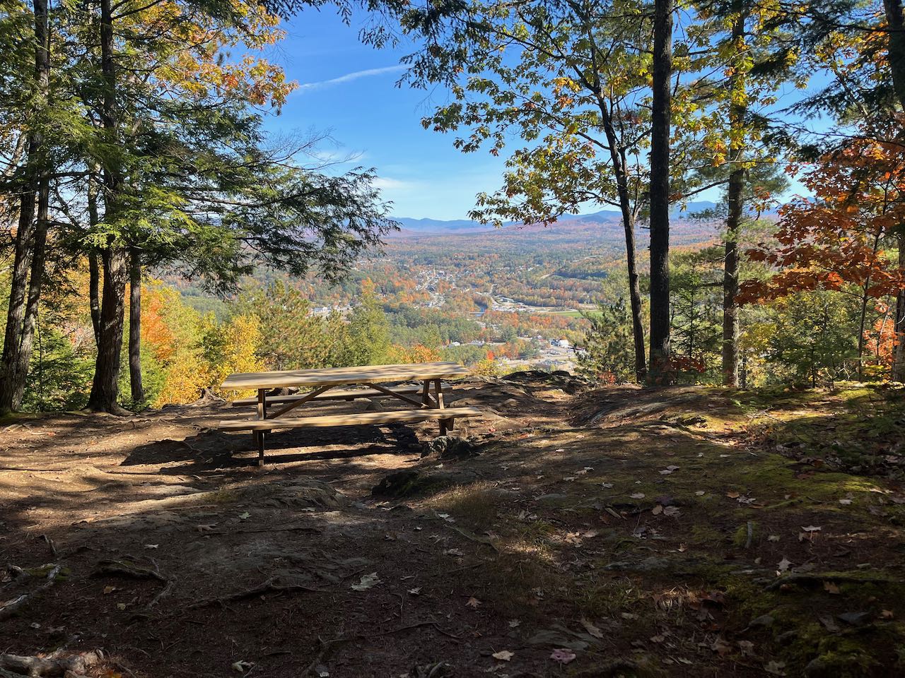
This local delight is brought to you by the Littleton Conservation Commission. The town maintains a pleasant and gentle hiking trail up to a cleared lookout on the north end of the Walker Mountain ridge. Located well outside the main thoroughfares of the central White Mountains, this viewpoint is perched just above the town center of Littleton and offers the rare perspective of viewing New Hampshire's two highest mountain ranges in the same frame together. This and a birds-eye vista of the quaint downtown are yours for the low price of a less-than-a-mile jaunt up this well-cared for trail.
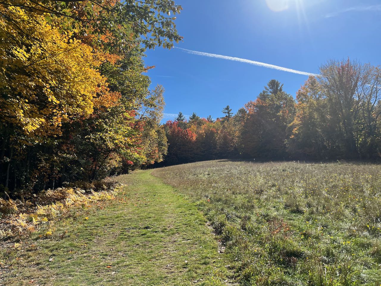
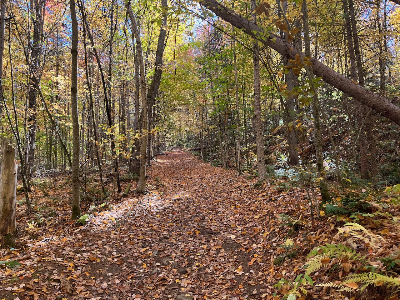
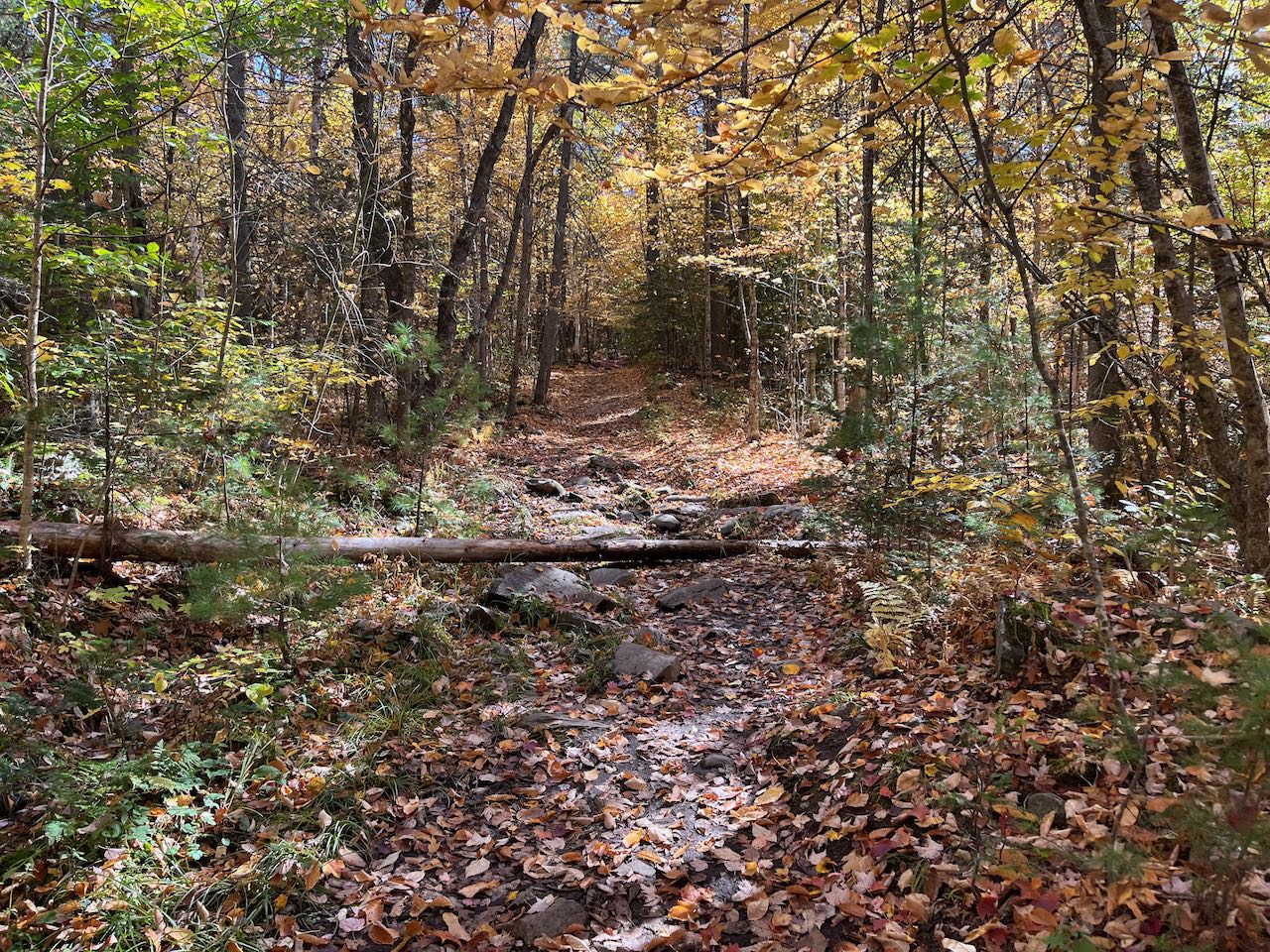
Starting at the kiosk, walk uphill along the left edge of the field in a mowed strip. When you reach the top of the clearing, you have already gone 0.15 miles. Look behind you to scope out the terrain of the surrounding hills. Follow the pathway into the woods at the upper left corner of the field as it becomes a wide and well-graded dirt path. It rises steadily over the next 0.2 miles on a moderate incline, passing a wooden bench before flattening out. With the steepest part behind you, follow the pathway on the level, forking left at an arrow sign in another 0.1 miles as another woods road diverges right. Crossing through a few occasionally muddy spots, the trail climbs easily for a quarter mile to reach the top of the Walker Mountain ridge, passing another bench and forking left again at a second arrow sign as it approaches. The trail swings left under tall tree cover and passes beside the minor knoll above the lookout. It then descends briefly to the clearing, reaching it in another 0.15 miles.
From your vantage point at the picnic table in the center of the clearing, you observe a grand sweep of the mountains. The Presidential Range is the centerpiece of the view, sprawling across the landscape with both the northern and southern peaks in view. Cherry Mountain is a prominent feature on the left side. To the right, behind the twin hills of Mts. Agassiz and Cleveland, is the northern wall of the Twin Range, including Mt. Hale and North and South Twin Mountains. Triangular Mt. Garfield divides them from the high alpine Franconia Ridge, with Mts. Lafayette, Lincoln, and Liberty visible. If you peek around the trees from further over on the left side of the clearing, you can also see Cannon Mountain across Franconia Notch from them. Right below you is the town of Littleton, bisected by the reflective Ammonoosuc River.
Printable directions page